.svg)


Be at the forefront of insightful design by integrating geographical information system (GIS) data into your BIM workflows and other site design workflows. Our new partnership with Esri will get you there.
Though Vectorworks supports a number of different file formats to import geospatial data, imagery and survey points, the process of importing information means that you are limited to the files that you have on hand.
Now, with Vectorworks 2020, Architect, Landmark, and Designer users have access to online mapping and aerial images with Esri’s ArcGIS Online, the world’s most powerful mapping and spatial analytics software.

A Look at the New Integration
Access to ArcGIS can be obtained through two new Vectorworks tools: Geoimage and Geolocate. This new Vectorworks functionality performs similarly to other plugins managed by Graebert’s Ares Map and ArcGIS for AutoCAD, utilizing Esri’s application programming interfaces (API).
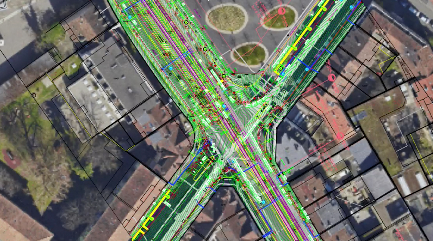
With proper geographic coordinates and projection in the Vectorworks file, street map imagery and aerial imagery can be immediately placed into the design layer. Depending on the user’s paid ArcGIS online service plan, other mapping imagery can be imported as well. Cropping is an essential part of this feature, since most mapping outputs will depict the street mapping and aerial imagery beyond the project site.
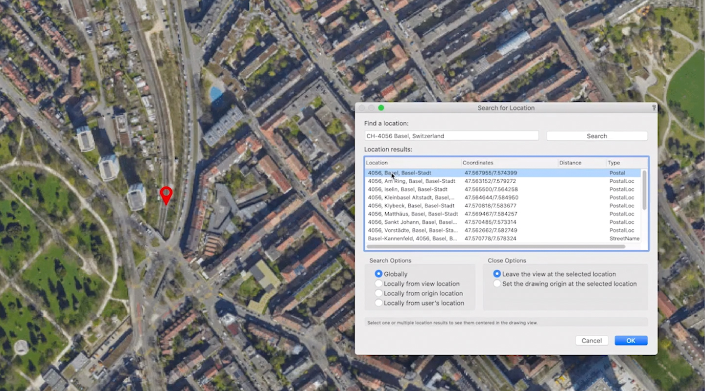
With Geolocate, the simple entering of a project address will locate your project site, as well as suggest the best projection to use, completely based on user preference. This will also identify the new origin as the referenced position of the mapping, not only saving time, but also alleviating the challenge of relocating geolocated items to preserve performance — a task that usually suffers when the item is too far away from the project origin, 0,0.
How Vectorworks Compares
Though a few plugin solutions exist that work off of the products and services of ArcGIS online, Vectorworks’ Landmark, Architect, and Designer can provide a slight advantage. Here’s how:
- Compared to Graebert’s Ares product line, which is focused on general CAD and file creation and modification, Vectorworks provides a far more advanced BIM and site solution.
- The ArcGIS for AutoCAD plugin enables general CAD users access to Esri products and services, but because AutoCAD isn’t a BIM authoring application, it lacks industry-specific tools for the AEC and landscape architecture/planning market. With Vectorworks you have the purpose-built BIM tools you need in addition to GIS file integration.
- The combination of ArcGIS for AutoCAD and Civil3D provides a powerpack of tools for civil engineers working on site planning projects, with additional access to GIS context. However, if those using Civil3D prefer to have landscape-focused tools, especially BIM for landscape architecture, their needs are better met with Vectorworks’ Landmark or Designer.
- Bentley’s Bentley Map offers the connection between Microstation and GIS, which like Civil3D offers a variety of tools for civil and infrastructure design professionals — but is also lacking where BIM for landscape architecture is concerned.
- A GIS integration for Revit will add GIS context to the building design professional’s space. However, this still lacks the BIM for landscape architecture connection to GIS that Vectorworks’ Landmark and Designer can offer.

The Bottom Line
Partnering with Esri was a match that needed to happen: Esri could help identify customers where the combination of Esri products and services, along with the graphically rich BIM tools of Vectorworks Landmark, could enhance local site design work.
Not only is this particular GIS integration and partnership a benefit to building urban design and planning markets for Vectorworks, but also our AEC, landscape architecture, and landscape design users can benefit from our latest features. The access to GIS imagery, data, and geometry can now be much quicker — and with the integration of Esri’s map services, this map data is now instantly available.
Want to give ArcGIS Online and Vectorworks 2020 a try?

Special thanks to Eric Gilbey, Vectorworks Product Marketing Manager - Landscape, for his contributions to this blog post.
